
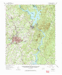
1957 Map of Albemarle
USGS Topo · Published 1958About this map
The Yadkin River and its transition into the Pee Dee River define the eastern landscape of this mid-century survey, marked by the extensive impoundments of Badin Lake and Lake Tillery. At the heart of the region, the city of Albemarle shows its mid-1950s footprint, featuring the Albemarle High Sch and a State Prison facility on its outskirts. The industrial and infrastructure character of the era is evident through the Powerplant near Badin and the Winston-Salem Southbound railroad line.
Find a feature on this map
101 named features on this map. Tap any name to fly to it.
Don’t see what you’re looking for? This feature index may not catch every label — zoom into the map to look around manually.
Map Details
Editions of this 1957 Albemarle Map
2 editions found
Other maps of this area

1942 · Troy
USGS Topo · 1:125,000

1949 · High Rock
USGS Topo · 1:24,000

1953 · Raleigh
USGS Topo · 1:250,000

1953 · Charlotte
USGS Topo · 1:250,000

1954 · Charlotte
USGS Topo · 1:250,000

1954 · Raleigh
USGS Topo · 1:250,000

1956 · Mount Gilead East
USGS Topo · 1:24,000

1956 · Mount Gilead West
USGS Topo · 1:24,000

1957 · Mount Pleasant
USGS Topo · 1:62,500

1957 · Denton
USGS Topo · 1:62,500