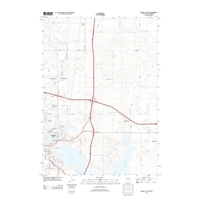
2013 Map of Albert Lea East
USGS Topo · Published 2013About this map
Albert Lea serves as the central hub of this 2013 survey, where the convergence of Interstate 35 and Interstate 90 shapes the modern landscape. The area is defined by its significant water bodies, including the expansive Albert Lea Lake and the intricate shoreline of Fountain Lake, which features Katherine Island. Local history is deeply embedded in the land through several burial sites, such as the Saint Theodore Cem and the Freeborn County Poor Farm Cem, reflecting the early social infrastructure of Freeborn County.
Find a feature on this map
91 named features on this map. Tap any name to fly to it.
Don’t see what you’re looking for? This feature index may not catch every label — zoom into the map to look around manually.
Map Details
Editions of this 2013 Albert Lea East Map
This is the sole edition of this map. No revisions or reprints were ever made.
Other maps of this area

1954 · Albert Lea
USGS Topo · 1:62,500

1954 · Hayward
USGS Topo · 1:62,500

1954 · Mason City
USGS Topo · 1:250,000

1957 · Mason City
USGS Topo · 1:250,000

1958 · Mason City
USGS Topo · 1:250,000

1967 · Hollandale
USGS Topo · 1:24,000

1967 · Hartland
USGS Topo · 1:24,000

1967 · Ellendale
USGS Topo · 1:24,000

1982 · Hayward
USGS Topo · 1:24,000

1982 · Albert Lea West
USGS Topo · 1:24,000