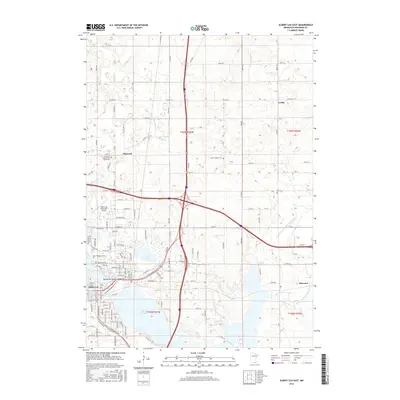
2016 Map of Albert Lea East
USGS Topo · Published 2016About this map
Albert Lea Lake and the interconnected waters of Fountain Lake and Goose Lake dominate this portion of Freeborn County, illustrating a landscape defined by its glacial hydrology. The city of Albert Lea serves as a central hub where the regional road network converges, including the major intersection of Interstate 90 and Interstate 35. This modern survey provides significant value for genealogists and local historians, as it meticulously identifies several burial sites such as the Freeborn County Poor Farm Cem, East Freeborn Cem, and Saint Theodore Cem. Beyond the urban center, the land is marked by an extensive drainage system, featuring County Ditch Number Sixtyfive and County Ditch Number Twentytwo, which reflects the area's agricultural engineering. Small settlements like Bancroft and Lerdal appear alongside aviation infrastructure at the Albert Lea Municipal Airport.
Find a feature on this map
129 named features on this map. Tap any name to fly to it.
Don’t see what you’re looking for? This feature index may not catch every label — zoom into the map to look around manually.
Map Details
Editions of this 2016 Albert Lea East Map
This is the sole edition of this map. No revisions or reprints were ever made.
Other maps of this area

1954 · Albert Lea
USGS Topo · 1:62,500

1954 · Hayward
USGS Topo · 1:62,500

1954 · Mason City
USGS Topo · 1:250,000

1957 · Mason City
USGS Topo · 1:250,000

1958 · Mason City
USGS Topo · 1:250,000

1967 · Hollandale
USGS Topo · 1:24,000

1967 · Hartland
USGS Topo · 1:24,000

1967 · Ellendale
USGS Topo · 1:24,000

1982 · Hayward
USGS Topo · 1:24,000

1982 · Albert Lea West
USGS Topo · 1:24,000