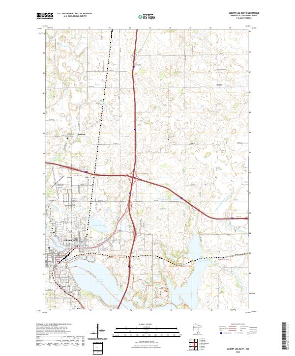
2022 Map of Albert Lea East
USGS Topo · Published 2022About this map
The city of Albert Lea serves as the focal point of this modern topographic survey, situated at the convergence of major regional transit routes and significant water bodies. The landscape is defined by the expansive Albert Lea Lake and the intricate channels of Fountain Lake, which contains Katherine Island. To the north and east, the map detail transitions into a rural grid pattern where small communities like Bancroft and Lerdal persist alongside an extensive drainage network, including the County Ditch Number Fifteen and Peter Lund Creek.
Find a feature on this map
83 named features on this map. Tap any name to fly to it.
Don’t see what you’re looking for? This feature index may not catch every label — zoom into the map to look around manually.
Map Details
Editions of this 2022 Albert Lea East Map
This is the sole edition of this map. No revisions or reprints were ever made.
Other maps of this area

1954 · Albert Lea
USGS Topo · 1:62,500

1954 · Hayward
USGS Topo · 1:62,500

1954 · Mason City
USGS Topo · 1:250,000

1957 · Mason City
USGS Topo · 1:250,000

1958 · Mason City
USGS Topo · 1:250,000

1967 · Hollandale
USGS Topo · 1:24,000

1967 · Hartland
USGS Topo · 1:24,000

1967 · Ellendale
USGS Topo · 1:24,000

1982 · Hayward
USGS Topo · 1:24,000

1982 · Albert Lea West
USGS Topo · 1:24,000