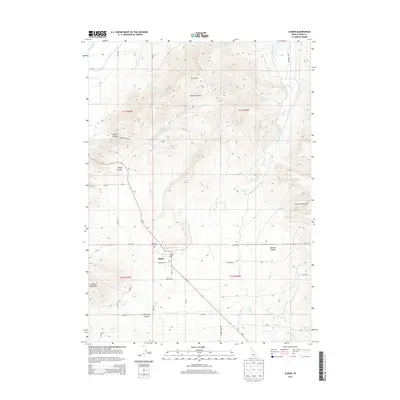
2013 Map of Albion
USGS Topo · Published 2013About this map
Albion sits at the heart of this high-elevation valley, flanked by the Albion Mountains to the west and the Cotterel Mountains to the east. The 2013 landscape reveals a community defined by its water management and agricultural grid, with the H Canal and L Canal cutting through the northern reaches. The settlement is centered on Main St and Tremayne St, while the Pleasant Hill Cem provides a point of genealogical interest just northwest of the town center. The surrounding terrain is deeply carved by drainage systems such as Marsh Cr, Howell Cr, and Land Cr, while landmarks like East Hills and Harroun Canyon characterize the rugged eastern boundary. The presence of Water Canyon Spring and Bridger Spring suggests the critical importance of these natural water sources to the local geography and ranching history of Cassia County.
Find a feature on this map
44 named features on this map. Tap any name to fly to it.
Don’t see what you’re looking for? This feature index may not catch every label — zoom into the map to look around manually.
Map Details
Editions of this 2013 Albion Map
This is the sole edition of this map. No revisions or reprints were ever made.
Other maps of this area

1954 · Pocatello
USGS Topo · 1:250,000

1958 · Pocatello
USGS Topo · 1:250,000

1959 · Lake Walcott
USGS Topo · 1:62,500

1964 · Rupert SE
USGS Topo · 1:24,000

1964 · View
USGS Topo · 1:24,000

1964 · Rupert SW
USGS Topo · 1:24,000

1968 · Idahome
USGS Topo · 1:24,000

1968 · Mount Harrison
USGS Topo · 1:24,000

1968 · Nibbs Creek
USGS Topo · 1:24,000

1968 · Albion
USGS Topo · 1:24,000