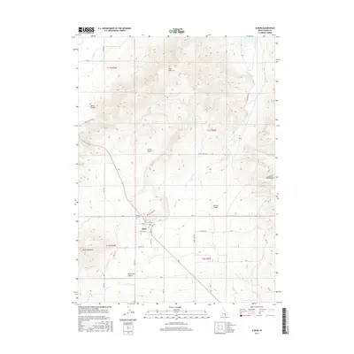
2017 Map of Albion
USGS Topo · Published 2017About this map
Albion sits at the heart of this high-desert basin, where the agricultural grid meets the rising foothills of the Albion Mountains and the Cotterel Mountains. The town's layout, defined by Main St and Market St, reflects its history as a remote valley hub, supported by the complex drainage systems of Marsh Cr and Howell Cr. North of the settlement, Pleasant Hill Cem occupies a prominent position near Mountain View Rd, serving as a significant genealogical landmark for the region's long-established ranching and farming families. The surrounding landscape is heavily dissected by prominent landforms such as White Pine Canyon, Spring Canyon, and the East Hills, illustrating a terrain where seasonal water sources like Bridger Spring and Water Canyon Spring were historically vital for local subsistence and livestock.
Find a feature on this map
44 named features on this map. Tap any name to fly to it.
Don’t see what you’re looking for? This feature index may not catch every label — zoom into the map to look around manually.
Map Details
Editions of this 2017 Albion Map
This is the sole edition of this map. No revisions or reprints were ever made.
Other maps of this area

1954 · Pocatello
USGS Topo · 1:250,000

1958 · Pocatello
USGS Topo · 1:250,000

1959 · Lake Walcott
USGS Topo · 1:62,500

1964 · Rupert SE
USGS Topo · 1:24,000

1964 · View
USGS Topo · 1:24,000

1964 · Rupert SW
USGS Topo · 1:24,000

1968 · Idahome
USGS Topo · 1:24,000

1968 · Mount Harrison
USGS Topo · 1:24,000

1968 · Nibbs Creek
USGS Topo · 1:24,000

1968 · Albion
USGS Topo · 1:24,000