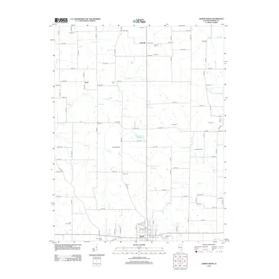
2012 Map of Albion North
USGS Topo · Published 2012About this map
Village Prairie defines the central landscape of this Edwards County region, where agricultural traditions intersect with the Bone Gap Oil Field. The area north of Albion is characterized by a dense network of country roads connecting scattered rural settlements like Samsville and Black. This survey highlights the deep genealogical roots of the community through its numerous burial grounds, including the West Village Cem, Shiloh Cem, and Wanborough Cem. Waterways such as W Village Cr and Little Indian Cr carve through the prairie, providing natural drainage for the surrounding farmland. The presence of Moose Lake and various family-named cemeteries like Carney Cem and Potter Cem underscores the long-standing private land ownership and local heritage that has shaped this Illinois interior.
Find a feature on this map
95 named features on this map. Tap any name to fly to it.
Don’t see what you’re looking for? This feature index may not catch every label — zoom into the map to look around manually.
Map Details
Editions of this 2012 Albion North Map
This is the sole edition of this map. No revisions or reprints were ever made.
Other maps of this area

1903 · Patoka
USGS Topo · 1:125,000

1904 · Mount Carmel
USGS Topo · 1:62,500

1911 · Sumner
USGS Topo · 1:62,500

1913 · Sumner
USGS Topo · 1:62,500

1943 · Albion
USGS Topo · 1:62,500

1946 · Albion
USGS Topo · 1:62,500

1949 · Olney
USGS Topo · 1:62,500

1956 · Vincennes
USGS Topo · 1:250,000

1957 · Vincennes
USGS Topo · 1:250,000

1958 · Vincennes
USGS Topo · 1:250,000