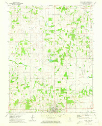
1971 Map of Albion North
USGS Topo · Published 1973About this map
The Bone Gap Oil Field and numerous scattered Oil Wells define the industrial character of this Edwards County landscape in the early 1970s. Agriculture and energy extraction exist side-by-side near the settlements of Albion, Bone Gap, and Samsville. The rural social fabric is anchored by several country congregations and burying grounds, including Ebenezer Ch, West Village Ch, and Medler Cem. The Illinois Central railroad cuts through the eastern portion of the map, providing a vital transport link for the region's commodities. Waterways such as West Village Creek and Little Indian Creek wind through the terrain, occasionally pooling into features like Moose Lake. This survey illustrates the steady persistence of small Illinois towns and their surrounding oil interests before significant modern consolidation altered the rural township structure.
Find a feature on this map
35 named features on this map. Tap any name to fly to it.
Don’t see what you’re looking for? This feature index may not catch every label — zoom into the map to look around manually.
Map Details
Editions of this 1971 Albion North Map
This is the sole edition of this map. No revisions or reprints were ever made.
Other maps of this area

1903 · Patoka
USGS Topo · 1:125,000

1904 · Mount Carmel
USGS Topo · 1:62,500

1911 · Sumner
USGS Topo · 1:62,500

1913 · Sumner
USGS Topo · 1:62,500

1943 · Albion
USGS Topo · 1:62,500

1946 · Albion
USGS Topo · 1:62,500

1949 · Olney
USGS Topo · 1:62,500

1956 · Vincennes
USGS Topo · 1:250,000

1957 · Vincennes
USGS Topo · 1:250,000

1958 · Vincennes
USGS Topo · 1:250,000