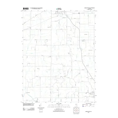
2012 Map of Albion South
USGS Topo · Published 2012About this map
English Prairie and Long Prairie dominate the landscape of Edwards County, where agricultural patterns are punctuated by extensive petroleum extraction. This 2012 survey details the Albion Oil Field and Albion East Oil Field, illustrating the enduring footprint of the oil industry across the rural township. For genealogists, the map is remarkably dense with burial grounds, ranging from the James Hean Family Cem and Birk Prairie Cem to the Catholic Cem. The terrain is drained by a network of creeks including French Creek and Onion Creek, eventually reaching the Little Wabash River at Dixon Shoals. The small settlement of Red Top sits at the northern edge, anchoring a grid of county roads that connect remote farmsteads and historic family landmarks.
Find a feature on this map
79 named features on this map. Tap any name to fly to it.
Don’t see what you’re looking for? This feature index may not catch every label — zoom into the map to look around manually.
Map Details
Editions of this 2012 Albion South Map
This is the sole edition of this map. No revisions or reprints were ever made.
Other maps of this area

1903 · New Harmony
USGS Topo · 1:62,500

1903 · Patoka
USGS Topo · 1:125,000

1904 · Mount Carmel
USGS Topo · 1:62,500

1938 · New Harmony
USGS Topo · 1:62,500

1940 · Carmi
USGS Topo · 1:62,500

1943 · Carmi
USGS Topo · 1:62,500

1943 · Albion
USGS Topo · 1:62,500

1946 · Albion
USGS Topo · 1:62,500

1956 · Vincennes
USGS Topo · 1:250,000

1957 · Vincennes
USGS Topo · 1:250,000