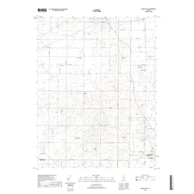
2018 Map of Albion South
USGS Topo · Published 2018About this map
Albion anchors the northern edge of this agricultural landscape in southeastern Illinois. Situated on the ridge between the Bonpas Creek and Little Wabash River watersheds, the town is the historic county seat and central hub for the surrounding rural townships. The map details a countryside shaped by meandering watercourses such as Stinking Cr, Onion Cr, and Harper Cr, which cut through the farm plots. Evidence of early settlement and local heritage is preserved in the numerous family and community burial grounds, including Birk Prairie Cem, Mount Zion Cem, and West Cem, which serve as vital landmarks for tracing the genealogical history of Edwards and White Counties.
Find a feature on this map
1 named feature on this map. Tap any name to fly to it.
Don’t see what you’re looking for? This feature index may not catch every label — zoom into the map to look around manually.
Map Details
Editions of this 2018 Albion South Map
This is the sole edition of this map. No revisions or reprints were ever made.
Other maps of this area

1903 · New Harmony
USGS Topo · 1:62,500

1903 · Patoka
USGS Topo · 1:125,000

1904 · Mount Carmel
USGS Topo · 1:62,500

1938 · New Harmony
USGS Topo · 1:62,500

1940 · Carmi
USGS Topo · 1:62,500

1943 · Carmi
USGS Topo · 1:62,500

1943 · Albion
USGS Topo · 1:62,500

1946 · Albion
USGS Topo · 1:62,500

1956 · Vincennes
USGS Topo · 1:250,000

1957 · Vincennes
USGS Topo · 1:250,000