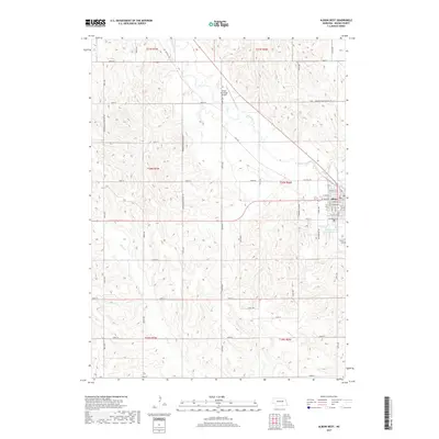
2017 Map of Albion West
USGS Topo · Published 2017About this map
Albion sits at the eastern edge of this landscape, its residential grid defined by streets like W State St and W Marengo St. The surrounding Boone County terrain is a detailed network of agricultural sections, marked by a precise grid of rural roads and minimum maintenance routes. The northern reaches are characterized by the winding path of Beaver Creek, which flows past the Albion Municipal Airport and near the historic corridor of Old Mill Rd. To the south, the waters of Plum Cr and the Kohtz-City of Albion Reservoir highlight the region's managed water resources. For those tracing local heritage, the Albion Cem and the nearby Fairgrounds Rd provide fixed points of interest within the town's immediate outskirts.
Find a feature on this map
42 named features on this map. Tap any name to fly to it.
Don’t see what you’re looking for? This feature index may not catch every label — zoom into the map to look around manually.
Map Details
Editions of this 2017 Albion West Map
This is the sole edition of this map. No revisions or reprints were ever made.
Other maps of this area

1954 · Cedar Rapids
USGS Topo · 1:24,000

1954 · Akron
USGS Topo · 1:24,000

1954 · Albion West
USGS Topo · 1:24,000

1954 · Cedar Rapids SE
USGS Topo · 1:24,000

1955 · Broken Bow
USGS Topo · 1:250,000

1955 · Fremont
USGS Topo · 1:250,000

1956 · Broken Bow
USGS Topo · 1:250,000

1957 · Fremont
USGS Topo · 1:250,000

1958 · Fremont
USGS Topo · 1:250,000

1958 · Albion East
USGS Topo · 1:24,000