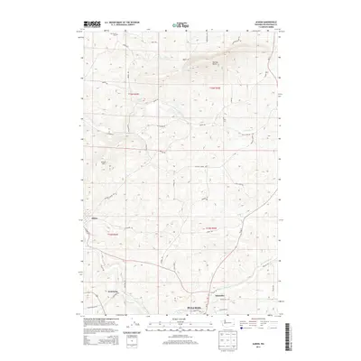
2014 Map of Albion
USGS Topo · Published 2014About this map
The S Fork Palouse River and its numerous tributaries, including Fourmile Creek and Rose Creek, define the drainage patterns of this Whitman County landscape. The settlement of Albion sits near the western edge, while smaller localities like Armstrong and Kitzmiller are positioned along the primary north-south corridor of Wa-27. Distinctive relief is provided by prominent landmarks such as Kamiak Butte and Smoot Hill, which rise above the surrounding agricultural fields and rolling hills. For those researching local history or genealogy, the map identifies specific points of interest including Mt Olivet Cemetery and Pitts Cemetery. The network of country roads, such as Parvin Road and Palouse Albion Road, connects these early communities to the northern outskirts of Pullman, illustrating the enduring spatial relationship between the university town and its rural neighbors.
Find a feature on this map
50 named features on this map. Tap any name to fly to it.
Don’t see what you’re looking for? This feature index may not catch every label — zoom into the map to look around manually.
Map Details
Editions of this 2014 Albion Map
This is the sole edition of this map. No revisions or reprints were ever made.
Other maps of this area

1910 · Pullman
USGS Topo · 1:125,000

1955 · Pullman
USGS Topo · 1:250,000

1958 · Pullman
USGS Topo · 1:250,000

1964 · Viola
USGS Topo · 1:24,000

1964 · Elberton
USGS Topo · 1:24,000

1964 · Moscow West
USGS Topo · 1:24,000

1964 · Colfax North
USGS Topo · 1:24,000
1964 · Albion
USGS Topo · 1:24,000

1964 · Colfax South
USGS Topo · 1:24,000
1964 · Palouse
USGS Topo · 1:24,000