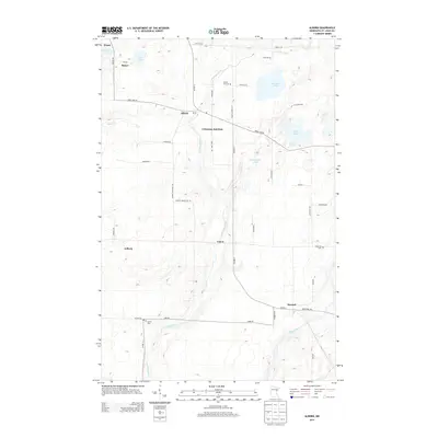
2013 Map of Alborn
USGS Topo · Published 2013About this map
The Artichoke River defines the central corridor of this Saint Louis County landscape, winding south from Alborn through Coleraine Junction toward its confluence with the Cloquet River. This 2013 survey illustrates a sparsely populated region of Northern Minnesota, where small settlements like Culver and Burnett are linked by a grid of rural roads and established highways such as Co HWY-7. Local history is preserved in sites like the Spruce Hill Cem and Industrial Cem, alongside legacy place names like Prosit and Arlberg. The map documents a landscape characterized by its water bodies, including Artichoke Lake, Schelin Lake, and Eier Lake, which sit amidst a network of township roads and county routes that have long supported the area's rural economy and access to its glacial lake features.
Find a feature on this map
47 named features on this map. Tap any name to fly to it.
Don’t see what you’re looking for? This feature index may not catch every label — zoom into the map to look around manually.
Map Details
Editions of this 2013 Alborn Map
This is the sole edition of this map. No revisions or reprints were ever made.
Other maps of this area

1953 · Canyon
USGS Topo · 1:24,000

1953 · Saginaw
USGS Topo · 1:24,000

1953 · Payne
USGS Topo · 1:24,000

1953 · Alborn
USGS Topo · 1:24,000

1953 · Brookston
USGS Topo · 1:24,000

1953 · Independence
USGS Topo · 1:24,000

1953 · Brookston NW
USGS Topo · 1:24,000

1953 · Duluth
USGS Topo · 1:250,000

1954 · Martin Lake
USGS Topo · 1:24,000

1954 · Hibbing
USGS Topo · 1:250,000