
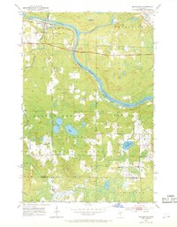
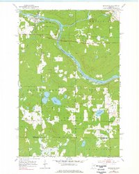
1953 Map of Brookston
USGS Topo · Published 1955About this map
The St Louis River and Cloquet River converge in this northern landscape, forming a watery junction that defined the early transport and settlement patterns of southern St. Louis County. The Great Northern railroad tracks parallel the river's path, serving the small community of Brookston and connecting the region's extractive industries to larger markets. Much of the southern half of the map is occupied by the Fond Du Lac Indian Reservation, where the terrain is marked by dense wetlands and numerous small bodies of water like Twin Lakes and Simian Lake. Local history is anchored by the Birch Lake Cem and Brevator Cem, while a small Landing Field and several scattered Gravel Pit locations suggest a mid-century economy built on resource management and local aviation.
Find a feature on this map
18 named features on this map. Tap any name to fly to it.
Don’t see what you’re looking for? This feature index may not catch every label — zoom into the map to look around manually.
Map Details
Editions of this 1953 Brookston Map
3 editions found
Other maps of this area

1953 · Saginaw
USGS Topo · 1:24,000

1953 · Alborn
USGS Topo · 1:24,000

1953 · Independence
USGS Topo · 1:24,000

1953 · Brookston NW
USGS Topo · 1:24,000

1953 · Duluth
USGS Topo · 1:250,000

1954 · Cloquet
USGS Topo · 1:24,000

1954 · Iverson
USGS Topo · 1:24,000

1954 · Sawyer
USGS Topo · 1:24,000

1954 · Martin Lake
USGS Topo · 1:24,000

1956 · Barnum
USGS Topo · 1:62,500