
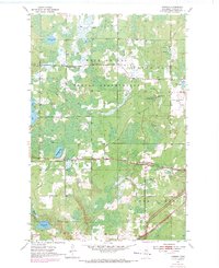
1954 Map of Iverson
USGS Topo · Published 1955About this map
The Fond Du Lac Indian Reservation covers the northern half of this mid-century landscape, where the Northern Pacific railroad cuts a straight line through the wetland-heavy terrain of Carlton County. The settlement of Iverson sits directly on this rail line, serving as a focal point between the marshy basins of Wild Rice Lake and the branching waters of Little Otter Creek. This area illustrates a mid-century balance of conservation, aviation, and industry, featuring the Cloquet Forest Experiment Station and the Cloquet Municipal Airport near the eastern border.
Find a feature on this map
20 named features on this map. Tap any name to fly to it.
Don’t see what you’re looking for? This feature index may not catch every label — zoom into the map to look around manually.
Map Details
Editions of this 1954 Iverson Map
2 editions found
Other maps of this area

1953 · Saginaw
USGS Topo · 1:24,000

1953 · Brookston
USGS Topo · 1:24,000

1953 · Duluth
USGS Topo · 1:250,000

1954 · Cloquet
USGS Topo · 1:24,000

1954 · Wrenshall
USGS Topo · 1:24,000

1954 · Atkinson
USGS Topo · 1:24,000

1954 · Sawyer
USGS Topo · 1:24,000

1954 · Martin Lake
USGS Topo · 1:24,000

1956 · Barnum
USGS Topo · 1:62,500

1958 · Duluth
USGS Topo · 1:250,000