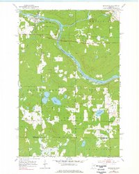
1953 Map of Brookston
USGS Topo · Published 1978About this map
The St Louis River and the Cloquet River converge at the northern edge of this territory, where the settlement of Brookston serves as a junction for the Great Northern railroad. Much of the southern landscape is defined by the Fond Du Lac Reservation, which encompasses several interior water bodies including Twin Lakes and Simian Lake. This 1950s era survey illustrates a landscape of dense wetlands and forest, partitioned by township boundaries such as Brevator and Stoney Brook. Rural life is marked by the presence of the Brevator Cem and Birch Lake Cem, while industry is represented by scattered Gravel Pit locations and a dedicated Landing Field. The map records the precise boundary between St Louis Co and Carlton Co, reflecting the administrative and natural geography of northeastern Minnesota before significant modern development.
Find a feature on this map
18 named features on this map. Tap any name to fly to it.
Don’t see what you’re looking for? This feature index may not catch every label — zoom into the map to look around manually.
Map Details
Editions of this 1953 Brookston Map
3 editions found
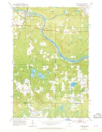
Other maps of this area

1953 · Saginaw
USGS Topo · 1:24,000

1953 · Alborn
USGS Topo · 1:24,000

1953 · Brookston
USGS Topo · 1:24,000

1953 · Independence
USGS Topo · 1:24,000

1953 · Brookston NW
USGS Topo · 1:24,000

1953 · Duluth
USGS Topo · 1:250,000

1954 · Cloquet
USGS Topo · 1:24,000

1954 · Iverson
USGS Topo · 1:24,000

1954 · Sawyer
USGS Topo · 1:24,000

1954 · Martin Lake
USGS Topo · 1:24,000