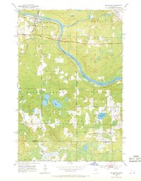
1953 Map of Brookston
USGS Topo · Published 1968About this map
The settlement of Brookston serves as a focal point at the confluence of Stoney Brook and the St Louis River in northern Minnesota. This mid-century landscape is dominated by the Fond Du Lac Indian Reservation, which occupies a significant portion of the terrain. The presence of the Great Northern railroad line alongside the river highlights the importance of rail transport for the region's industrial and logging sectors during the 1950s.
Find a feature on this map
16 named features on this map. Tap any name to fly to it.
Don’t see what you’re looking for? This feature index may not catch every label — zoom into the map to look around manually.
Map Details
Editions of this 1953 Brookston Map
3 editions found
Other maps of this area

1953 · Saginaw
USGS Topo · 1:24,000

1953 · Alborn
USGS Topo · 1:24,000

1953 · Brookston
USGS Topo · 1:24,000

1953 · Independence
USGS Topo · 1:24,000

1953 · Brookston NW
USGS Topo · 1:24,000

1953 · Duluth
USGS Topo · 1:250,000

1954 · Cloquet
USGS Topo · 1:24,000

1954 · Iverson
USGS Topo · 1:24,000

1954 · Sawyer
USGS Topo · 1:24,000

1954 · Martin Lake
USGS Topo · 1:24,000