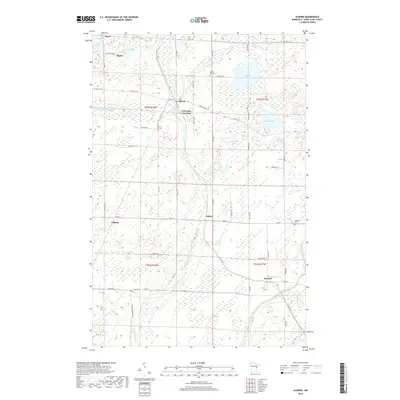
2019 Map of Alborn
USGS Topo · Published 2019About this map
Alborn and Coleraine Junction sit at the center of this 2019 survey, illustrating the persistence of small rail-aligned settlements in southern Saint Louis County. The landscape is defined by the winding course of the Artichoke River and the Cloquet River, which drain a complex network of wetlands and small lakes like Schelin Lake and Artichoke Lake. The mapping reveals a pattern of rural development focused along Co HWY 7 and HWY 8, connecting the hamlets of Culver and Burnett. Genealogists will find several burial sites noted, including Spruce Hill Cem near the northern edge and Culver Cem to the south. Further west, the map documents the smaller locales of Arlberg and Prosit, showing how the township grid and local roads like Alborn-Brookston Rd continue to organize this timber and wetland region.
Find a feature on this map
41 named features on this map. Tap any name to fly to it.
Don’t see what you’re looking for? This feature index may not catch every label — zoom into the map to look around manually.
Map Details
Editions of this 2019 Alborn Map
This is the sole edition of this map. No revisions or reprints were ever made.
Other maps of this area

1953 · Canyon
USGS Topo · 1:24,000

1953 · Saginaw
USGS Topo · 1:24,000

1953 · Payne
USGS Topo · 1:24,000

1953 · Alborn
USGS Topo · 1:24,000

1953 · Brookston
USGS Topo · 1:24,000

1953 · Independence
USGS Topo · 1:24,000

1953 · Brookston NW
USGS Topo · 1:24,000

1953 · Duluth
USGS Topo · 1:250,000

1954 · Martin Lake
USGS Topo · 1:24,000

1954 · Hibbing
USGS Topo · 1:250,000