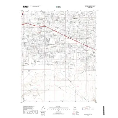
2020 Map of Albuquerque East
USGS Topo · Published 2020About this map
Albuquerque’s eastern reaches are defined by a sprawling urban grid that meets the rising terrain of Tijeras Canyon and the Tijeras Arroyo. The map captures a high-density cityscape featuring several distinct residential developments such as Hoffmantown, Vista Encantada, and Mesa Village. In the south, the extensive grounds of the Albuquerque International Sunport contrast with the open, undeveloped lands of the Kirtland Rd SE corridor. Academic and civic infrastructure is prominent, including the University of New Mexico Main Campus and the Fairview Memorial Park Cem. The landscape transition is evident where the dense street network of Central Ave gives way to the drainage systems of Arroyo del Embudo and Arroyo del Coyote near the mountain foothills.
Find a feature on this map
37 named features on this map. Tap any name to fly to it.
Don’t see what you’re looking for? This feature index may not catch every label — zoom into the map to look around manually.
Map Details
Editions of this 2020 Albuquerque East Map
This is the sole edition of this map. No revisions or reprints were ever made.
Other maps of this area

1888 · Bernalillo
USGS Topo · 1:125,000

1889 · Albuquerque
USGS Topo · 1:125,000

1892 · San Pedro
USGS Topo · 1:125,000

1893 · Albuquerque
USGS Topo · 1:125,000

1917 · Estancia
USGS Topo · 1:125,000

1934 · Alameda
USGS Topo · 1:24,000

1934 · West Albuquerque
USGS Topo · 1:24,000

1934 · Griegos
USGS Topo · 1:24,000

1934 · East Albuquerque
USGS Topo · 1:24,000

1938 · Albuquerque
USGS Topo · 1:62,500
Featured Places
- Albuquerque, NM
- Enchanted Park, Albuquerque
- Quail Ridge, Albuquerque
- Manzano Manor, Albuquerque
- Hoffmantown, Albuquerque