Loading...
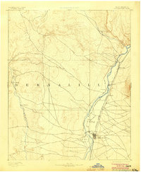
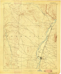
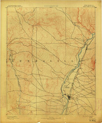
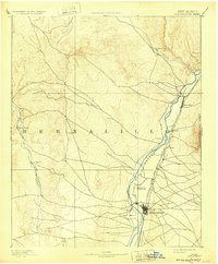
Loading map...1893 Map of Albuquerque
USGS Topo · Published 1904About this map
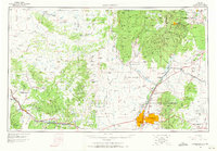
The Rio Grande valley serves as the primary corridor for settlement and transit in this late 19th-century survey of the high desert. The small grid of Albuquerque is centered along the Atchison Topeka and Santa Fe Railroad, while older riverside communities like Ranchos de Albuquerque, Artisco, and Alameda line the fertile valley floor. Further north, the convergence of Jemez Creek and the river anchors Bernalillo and the Santa Ana settlement.
Find a feature on this map
15 named features on this map. Tap any name to fly to it.
Don’t see what you’re looking for? This feature index may not catch every label — zoom into the map to look around manually.
Map Details
Date Portrayed1893
Date Published1904
PublisherU.S. Geological Survey
Map TypeTopographic
Scale1:125,000
Physical Dimensions16.6 x 20.1 inches
Editions of this 1893 Albuquerque Map
5 editions found

Historical Maps of Albuquerque Through Time
8 maps found


Featured Locations
Source Details
SourceU.S. Geological Survey
CopyrightPublic Domain