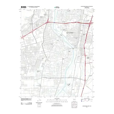
2010 Map of Albuquerque West
USGS Topo · Published 2010About this map
The Rio Grande flows through the heart of this 2010 survey, serving as the central artery for a complex network of historic irrigation systems including the Arenal Main Canal, Isleta Drain, and Barr Canal. These waterways define the transition between the modern urban sprawl of Albuquerque and the traditional agricultural footprints of the surrounding valley. Local history is deeply embedded in the map through numerous burial grounds such as Santa Clara Cemetery and the San Jose de Armijo Cemetery, which reflect the community's long-standing cultural roots.
Find a feature on this map
75 named features on this map. Tap any name to fly to it.
Don’t see what you’re looking for? This feature index may not catch every label — zoom into the map to look around manually.
Map Details
Editions of this 2010 Albuquerque West Map
This is the sole edition of this map. No revisions or reprints were ever made.
Other maps of this area

1888 · Bernalillo
USGS Topo · 1:125,000

1889 · Albuquerque
USGS Topo · 1:125,000

1893 · Albuquerque
USGS Topo · 1:125,000

1934 · Alameda
USGS Topo · 1:24,000

1934 · West Albuquerque
USGS Topo · 1:24,000

1934 · Griegos
USGS Topo · 1:24,000

1934 · East Albuquerque
USGS Topo · 1:24,000

1938 · Albuquerque
USGS Topo · 1:62,500

1952 · Wind Mesa
USGS Topo · 1:24,000

1952 · Hubbell Spring
USGS Topo · 1:24,000