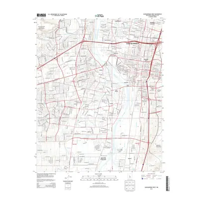
2013 Map of Albuquerque West
USGS Topo · Published 2013About this map
The Rio Grande serves as the central artery for this 2013 topographic study, dividing the sprawling metropolitan landscape of Albuquerque. On the western bank, the ancient volcanic escarpment is preserved within the Petroglyph National Monument, where Rinconada Canyon and Ladera Arroyo descend toward the river valley. The urban footprint is defined by a dense network of historic irrigation and drainage systems, including the Atrisco Riverside Drain and Arenal Main Canal, which reflect the region's enduring relationship with its water sources.
Find a feature on this map
232 named features on this map. Tap any name to fly to it.
Don’t see what you’re looking for? This feature index may not catch every label — zoom into the map to look around manually.
Map Details
Editions of this 2013 Albuquerque West Map
This is the sole edition of this map. No revisions or reprints were ever made.
Other maps of this area

1888 · Bernalillo
USGS Topo · 1:125,000

1889 · Albuquerque
USGS Topo · 1:125,000

1893 · Albuquerque
USGS Topo · 1:125,000

1934 · Alameda
USGS Topo · 1:24,000

1934 · West Albuquerque
USGS Topo · 1:24,000

1934 · Griegos
USGS Topo · 1:24,000

1934 · East Albuquerque
USGS Topo · 1:24,000

1938 · Albuquerque
USGS Topo · 1:62,500

1952 · Wind Mesa
USGS Topo · 1:24,000

1952 · Hubbell Spring
USGS Topo · 1:24,000