
1968 Map of Alcester NE
USGS Topo · Published 1970About this map
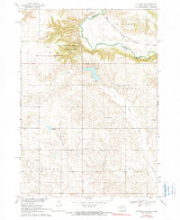
Newton Hills State Park anchors this 1960s landscape, where the deeply carved ravines of the Highland and Settlers townships meet the winding course of the Big Sioux River. The map illustrates a rural landscape defined by township grids and scattered local institutions that served the mid-century farming community. The Chicago Milwaukee St Paul and Pacific railroad tracks follow the river's path along the border between South Dakota and Iowa, connecting the remote reaches of Lincoln and Sioux counties.
Find a feature on this map
23 named features on this map. Tap any name to fly to it.
Don’t see what you’re looking for? This feature index may not catch every label — zoom into the map to look around manually.
Map Details
Editions of this 1968 Alcester NE Map
2 editions found
Other maps of this area

1897 · Canton
USGS Topo · 1:125,000

1900 · Canton
USGS Topo · 1:125,000

1955 · Sioux Falls
USGS Topo · 1:250,000

1958 · Sioux Falls
USGS Topo · 1:250,000

1962 · Canton
USGS Topo · 1:24,000

1964 · Canton SW
USGS Topo · 1:24,000

1968 · Alcester NW
USGS Topo · 1:24,000
1968 · Alcester
USGS Topo · 1:24,000
1968 · Alcester SE
USGS Topo · 1:24,000
1968 · Hawarden North
USGS Topo · 1:24,000