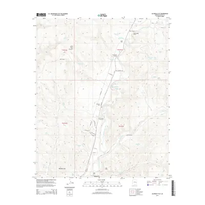
2014 Map of Alchesay Flat
USGS Topo · Published 2014About this map
Whiteriver and its northern residential extensions anchor the base of this canyon-dominated landscape, where the North Fork White River carves south through the mountainous terrain. The map captures a transition from the structured street grid of Rainbow City to the high-elevation flats and peaks of the Fort Apache Indian Reservation. A significant cultural landmark, the Chief Alchesay Baha Grave, sits prominently near Alchesay Flat, documenting the local heritage of the area.
Find a feature on this map
67 named features on this map. Tap any name to fly to it.
Don’t see what you’re looking for? This feature index may not catch every label — zoom into the map to look around manually.
Map Details
Editions of this 2014 Alchesay Flat Map
This is the sole edition of this map. No revisions or reprints were ever made.
Other maps of this area

1886 · St Johns
USGS Topo · 1:250,000

1886 · Holbrook
USGS Topo · 1:250,000

1892 · St Johns
USGS Topo · 1:250,000

1893 · Holbrook
USGS Topo · 1:250,000

1954 · Holbrook
USGS Topo · 1:250,000

1954 · Clifton
USGS Topo · 1:250,000

1954 · Saint Johns
USGS Topo · 1:250,000

1954 · Mesa
USGS Topo · 1:250,000

1957 · Mesa
USGS Topo · 1:250,000

1957 · Holbrook
USGS Topo · 1:250,000