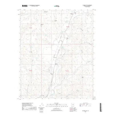
2018 Map of Alchesay Flat
USGS Topo · Published 2018About this map
The Chief Alchesay Baha Grave serves as a prominent landmark on this high-plateau landscape in Navajo County, situated near the settlement of Alchesay Flat. The geography is defined by the winding course of the North Fork White River, which carves through a series of deep drainages including Black Canyon, Cottonwood Canyon, and Goklish Canyon. This 2018 survey reveals a network of logging and tribal routes, such as Indian Rte 67 and the Lower Logging Rd, which facilitate movement between the wooded uplands and the river valley. Numerous water management features like the Holding Pasture Tank and Salt Trap Tank are scattered across the terrain, reflecting the area's pastoral and ranching utility. Landmarks like Little Round Top Mtn and Gold Butte provide clear navigational points for those exploring the canyon country.
Find a feature on this map
70 named features on this map. Tap any name to fly to it.
Don’t see what you’re looking for? This feature index may not catch every label — zoom into the map to look around manually.
Map Details
Editions of this 2018 Alchesay Flat Map
This is the sole edition of this map. No revisions or reprints were ever made.
Other maps of this area

1886 · St Johns
USGS Topo · 1:250,000

1886 · Holbrook
USGS Topo · 1:250,000

1892 · St Johns
USGS Topo · 1:250,000

1893 · Holbrook
USGS Topo · 1:250,000

1954 · Holbrook
USGS Topo · 1:250,000

1954 · Clifton
USGS Topo · 1:250,000

1954 · Saint Johns
USGS Topo · 1:250,000

1954 · Mesa
USGS Topo · 1:250,000

1957 · Mesa
USGS Topo · 1:250,000

1957 · Holbrook
USGS Topo · 1:250,000