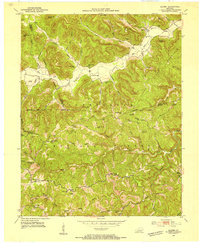
1952 Map of Alcorn
USGS Topo · Published 1954About this map
Cumberland National Forest dominates this 1952 topographic study, where the boundaries of Madison, Estill, and Jackson Counties converge among high ridges and deep hollows. The settlement pattern follows the intricate drainage of Red Lick Creek and Station Camp Creek, with small communities like Alcorn and Hisel tucked into narrow valleys. This era shows a landscape dense with local institutions, including the Indian Springs Sch and Beech Grove Ch, reflecting a time when isolated hollows maintained their own social centers.
Find a feature on this map
72 named features on this map. Tap any name to fly to it.
Don’t see what you’re looking for? This feature index may not catch every label — zoom into the map to look around manually.
Map Details
Editions of this 1952 Alcorn Map
3 editions found
Other maps of this area

1891 · Manchester
USGS Topo · 1:125,000

1892 · Richmond
USGS Topo · 1:125,000

1892 · Beattyville
USGS Topo · 1:125,000

1893 · London
USGS Topo · 1:125,000

1897 · Richmond
USGS Topo · 1:125,000

1897 · London
USGS Topo · 1:125,000

1952 · Alcorn
USGS Topo · 1:24,000

1952 · Leighton
USGS Topo · 1:24,000

1952 · Irvine
USGS Topo · 1:24,000

1952 · Bighill
USGS Topo · 1:24,000