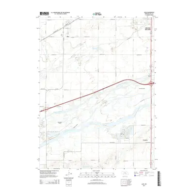
2014 Map of Alda
USGS Topo · Published 2014About this map
The braided channels of the Platte River dominate this Hall County landscape, creating a complex network of waterways and islands. Three distinct branches—the North Channel Platte River, Middle Channel Platte River, and South Channel Platte River—sweep across the terrain, isolating landmasses such as Shoemaker Island and Mormon Island. This fluvial geography has historically dictated the placement of transportation routes and settlements, with the village of Alda positioned to the north near the Wood River and the Grand Island city limits appearing at the eastern edge.
Find a feature on this map
44 named features on this map. Tap any name to fly to it.
Don’t see what you’re looking for? This feature index may not catch every label — zoom into the map to look around manually.
Map Details
Editions of this 2014 Alda Map
This is the sole edition of this map. No revisions or reprints were ever made.
Other maps of this area

1892 · Grand Island
USGS Topo · 1:62,500

1894 · Kenesaw
USGS Topo · 1:62,500

1895 · Grand Island
USGS Topo · 1:62,500

1895 · Wood River
USGS Topo · 1:62,500

1896 · Wood River
USGS Topo · 1:125,000

1898 · Grand Island
USGS Topo · 1:125,000

1955 · Grand Island
USGS Topo · 1:250,000

1957 · Grand Island
USGS Topo · 1:250,000

1958 · Grand Island
USGS Topo · 1:250,000

1962 · Prosser
USGS Topo · 1:24,000