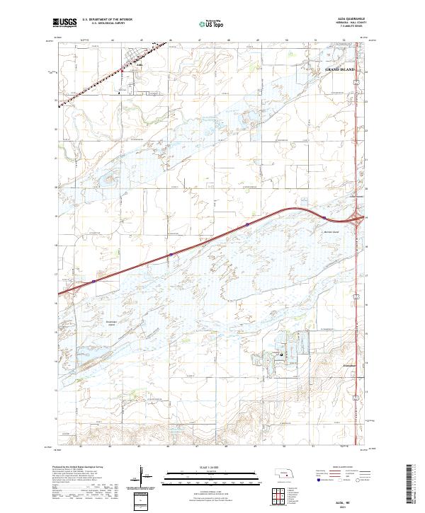
2021 Map of Alda
USGS Topo · Published 2021About this map
Alda and Doniphan anchor this central Nebraska landscape, which is defined by the complex, braided hydrology of the Platte River. In this 2021 study, the river is shown divided into the North Channel, Middle Channel, and South Channel, creating substantial landforms like Shoemaker Island and Mormon Island. These river islands and the surrounding floodplain dictate the local road grid, which must navigate around water features such as the Wood River and the Lautenschlager Reservoir. Genealogists and local historians can pinpoint specific burial sites at the Alda Cem and Campbell Cem, while the inclusion of a portion of Grand Island at the northeastern corner provides a look at the expansion of larger settlements toward these historically agricultural lands. The map illustrates how modern infrastructure, including the diagonal path of the interstate, cuts across the traditional section lines of the Public Land Survey System.
Find a feature on this map
62 named features on this map. Tap any name to fly to it.
Don’t see what you’re looking for? This feature index may not catch every label — zoom into the map to look around manually.
Map Details
Editions of this 2021 Alda Map
This is the sole edition of this map. No revisions or reprints were ever made.
Other maps of this area

1892 · Grand Island
USGS Topo · 1:62,500

1894 · Kenesaw
USGS Topo · 1:62,500

1895 · Grand Island
USGS Topo · 1:62,500

1895 · Wood River
USGS Topo · 1:62,500

1896 · Wood River
USGS Topo · 1:125,000

1898 · Grand Island
USGS Topo · 1:125,000

1955 · Grand Island
USGS Topo · 1:250,000

1957 · Grand Island
USGS Topo · 1:250,000

1958 · Grand Island
USGS Topo · 1:250,000

1962 · Prosser
USGS Topo · 1:24,000