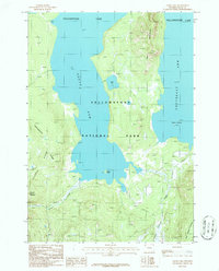
1986 Map of Alder Lake
USGS Topo · Published 1986About this map
Yellowstone National Park dominates this landscape, where the cold waters of Yellowstone Lake split into the South Arm Yellowstone Lake and the Southeast Arm Yellowstone Lake. This 1986 provisional survey documents a largely roadless interior defined by the Continental Divide and the high elevations of the Two Ocean Plateau. Local landmarks like The Promontory and Chicken Ridge rise above the drainage basins of Grouse Creek and Chipmunk Creek. Evidence of human presence is minimal, noted only by a lone Cabin and the Peale Island site, which were accessible primarily via a Pack Trail winding through the timber. The Molly Islands sit isolated in the southern reaches of the lake, providing a look at this protected wilderness before modern digital mapping replaced traditional field checks.
Find a feature on this map
16 named features on this map. Tap any name to fly to it.
Don’t see what you’re looking for? This feature index may not catch every label — zoom into the map to look around manually.
Map Details
Editions of this 1986 Alder Lake Map
This is the sole edition of this map. No revisions or reprints were ever made.
Other maps of this area

1885 · Lake
USGS Topo · 1:125,000

1895 · Lake
USGS Topo · 1:125,000

1896 · Lake
USGS Topo · 1:125,000

1901 · Lake
USGS Topo · 1:125,000

1906 · Lake
USGS Topo · 1:125,000

1911 · Lake
USGS Topo · 1:125,000

1955 · Ashton
USGS Topo · 1:250,000

1958 · Ashton
USGS Topo · 1:250,000
1959 · Mount Hancock
USGS Topo · 1:62,500
1959 · Two Ocean Pass
USGS Topo · 1:62,500