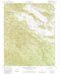
1949 Map of Alder Peak
USGS Topo · Published 1984About this map
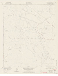
Santa Lucia Range peaks and high mountain canyons dominate this mid-century survey of Monterey County, centered on the rugged terrain of the Fort Hunter Liggett Military Reservation. The map captures a transitional landscape where high-altitude wilderness meets military infrastructure and ranching history. The Nacimiento River carves through the southeast, while the northern reaches open into the broad Stony Valley, marked by a remote Landing Strip and an Observation Post.
Find a feature on this map
27 named features on this map. Tap any name to fly to it.
Don’t see what you’re looking for? This feature index may not catch every label — zoom into the map to look around manually.
Map Details
Editions of this 1949 Alder Peak Map
7 editions found
Other maps of this area

1919 · King City
USGS Topo · 1:62,500

1919 · Junipero Serra
USGS Topo · 1:62,500

1919 · Bryson
USGS Topo · 1:62,500

1921 · Cape San Martin
USGS Topo · 1:62,500

1939 · King City
USGS Topo · 1:62,500

1941 · Cape San Martin
USGS Topo · 1:62,500

1941 · Junipero Serra
USGS Topo · 1:62,500

1941 · Bryson
USGS Topo · 1:62,500

1942 · Bryson
USGS Topo · 1:62,500

1942 · Cape San Martin
USGS Topo · 1:62,500