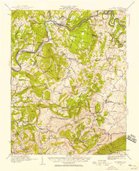
1921 Map of Alderson
USGS Topo · Published 1958About this map
The Greenbrier River carves a winding path through this corner of West Virginia, serving as the primary axis for development between Summers, Greenbrier, and Monroe counties. The Chesapeake and Ohio railroad follows the river's north bank, connecting riverside settlements like Alderson, Fort Spring, and Pence Springs. This rail-and-river network supported a landscape of diverse small-scale industry and rural social hubs, evidenced by surviving landmarks like Hokes Mill and Nickells Mill.
Find a feature on this map
121 named features on this map. Tap any name to fly to it.
Don’t see what you’re looking for? This feature index may not catch every label — zoom into the map to look around manually.
Map Details
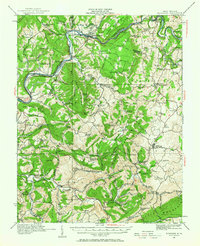
Editions of this 1921 Alderson Map
3 editions found

Other maps of this area

1887 · Hinton
USGS Topo · 1:125,000

1887 · Lewisburg
USGS Topo · 1:125,000

1890 · Dublin
USGS Topo · 1:125,000

1890 · Christiansburg
USGS Topo · 1:125,000

1891 · Lewisburg
USGS Topo · 1:125,000

1891 · Dublin
USGS Topo · 1:125,000

1892 · Hinton
USGS Topo · 1:125,000

1912 · Meadow Creek
USGS Topo · 1:48,000

1912 · Big Bend
USGS Topo · 1:62,500

1913 · Peterstown
USGS Topo · 1:48,000