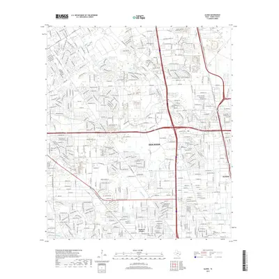
2019 Map of Aldine
USGS Topo · Published 2019About this map
Aldine and northern Houston neighborhoods dominate this landscape as it appeared in the late 2010s. The map captures a densely developed urban and suburban area north of the city center, defined by the heavy infrastructure of the Union Pacific railroad and major arteries like the Hardy Toll Rd and Tomball Pkwy. The drainage network, including Greens Bayou and Halls Bayou, dictates much of the remaining green space and parkland, such as Hyland Park, amidst the residential grid. For genealogists and local historians, the sheet is particularly valuable for its documentation of several distinct burial grounds, including Paradise Cem, Cem Beautiful, and Saint Joseph Cem. These sites, along with established communities like Highland Heights, provide a clear record of local settlement patterns and heritage in north Harris County.
Find a feature on this map
39 named features on this map. Tap any name to fly to it.
Don’t see what you’re looking for? This feature index may not catch every label — zoom into the map to look around manually.
Map Details
Editions of this 2019 Aldine Map
This is the sole edition of this map. No revisions or reprints were ever made.
Other maps of this area

1915 · Houston Heights
USGS Topo · 1:24,000

1915 · Hillendahl
USGS Topo · 1:24,000

1916 · Aldine
USGS Topo · 1:24,000

1916 · Settegast
USGS Topo · 1:24,000

1916 · Louetta
USGS Topo · 1:24,000

1916 · Satsuma
USGS Topo · 1:24,000

1916 · Humble
USGS Topo · 1:24,000

1916 · Spring
USGS Topo · 1:24,000

1918 · Hillendahl
USGS Topo · 1:31,680

1919 · Aldine
USGS Topo · 1:31,680