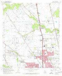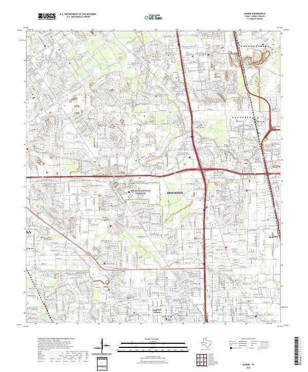
2022 Map of Aldine
USGS Topo · Published 2022About this map
The northern edge of Houston and the community of Aldine are defined by a complex intersection of major transit corridors and winding bayou systems. This 2022 survey captures the area where the North Fwy meets the Sam Houston Pkwy, creating a commercial and educational hub that includes Remington College Greenspoint Campus and the Lone Star College Greenspoint Center. The landscape is notably punctuated by several large memorial grounds, including the extensive Houston National Cem and Earthman Resthaven Cem.
Find a feature on this map
22 named features on this map. Tap any name to fly to it.
Don’t see what you’re looking for? This feature index may not catch every label — zoom into the map to look around manually.
Map Details
Editions of this 2022 Aldine Map
This is the sole edition of this map. No revisions or reprints were ever made.
Historical Maps of Weisenberger City Through Time
7 maps found