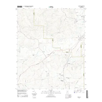
2014 Map of Aldrich
USGS Topo · Published 2014About this map
Brierfield and Ashby sit at the intersection of Bibb and Shelby counties, marking a landscape where rural settlements and water-powered industrial history converge. The Little Cahaba River winds through the western half of the map, while the University of Montevallo Lake and College Lake appear near the northern settlement of Aldrich. This area is particularly detailed for genealogists, featuring numerous burial grounds including Ebenezer Cem, Cahaba Valley Cem, and Six-Mile Cem. The mapping of small drainage systems like Furnace Br and Mahan Cr suggests a legacy of early iron manufacturing and milling that once defined this portion of the Alabama mineral belt. Traces of early transport and local commerce are evident near Fitch Bridge and along the various county roads that connect these small communities to Wilton and the surrounding countryside.
Find a feature on this map
90 named features on this map. Tap any name to fly to it.
Don’t see what you’re looking for? This feature index may not catch every label — zoom into the map to look around manually.
Map Details
Editions of this 2014 Aldrich Map
This is the sole edition of this map. No revisions or reprints were ever made.
Other maps of this area

1890 · Bessemer
USGS Topo · 1:125,000

1891 · Clanton
USGS Topo · 1:125,000

1892 · Bessemer
USGS Topo · 1:125,000

1899 · Brookwood
USGS Topo · 1:125,000

1910 · Montevallo
USGS Topo · 1:62,500

1934 · Blocton
USGS Topo · 1:48,000

1940 · Blocton
USGS Topo · 1:62,500

1953 · Montgomery
USGS Topo · 1:250,000

1953 · Birmingham
USGS Topo · 1:250,000

1956 · Birmingham
USGS Topo · 1:250,000