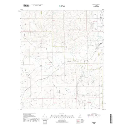
2020 Map of Aldrich
USGS Topo · Published 2020About this map
Montevallo and its university grounds serve as a primary hub where the hills of Central Alabama meet a complex network of creeks and historic crossings. This 2020 record of the region captures the meeting point of Bibb, Shelby, and Chilton counties, a landscape defined by its cemeteries and small settlements like Aldrich, Brierfield, and Ashby. Waterways including the Little Cahaba River, Mahan Creek, and Furnace Br snake through the terrain, historically supporting the early industrial and agricultural foundations of these communities. Genealogists will find a dense concentration of burial sites, from the Six Mile Cem in the southwest to the Cahaba Valley Cem and Carlton Hill Cem further north. The map details the local road network, such as Marvel Rd and Montevallo Rd, which links established town centers to the outlying rural reaches that have sustained the area's character for generations.
Find a feature on this map
98 named features on this map. Tap any name to fly to it.
Don’t see what you’re looking for? This feature index may not catch every label — zoom into the map to look around manually.
Map Details
Editions of this 2020 Aldrich Map
This is the sole edition of this map. No revisions or reprints were ever made.
Other maps of this area

1890 · Bessemer
USGS Topo · 1:125,000

1891 · Clanton
USGS Topo · 1:125,000

1892 · Bessemer
USGS Topo · 1:125,000

1899 · Brookwood
USGS Topo · 1:125,000

1910 · Montevallo
USGS Topo · 1:62,500

1934 · Blocton
USGS Topo · 1:48,000

1940 · Blocton
USGS Topo · 1:62,500

1953 · Montgomery
USGS Topo · 1:250,000

1953 · Birmingham
USGS Topo · 1:250,000

1956 · Birmingham
USGS Topo · 1:250,000