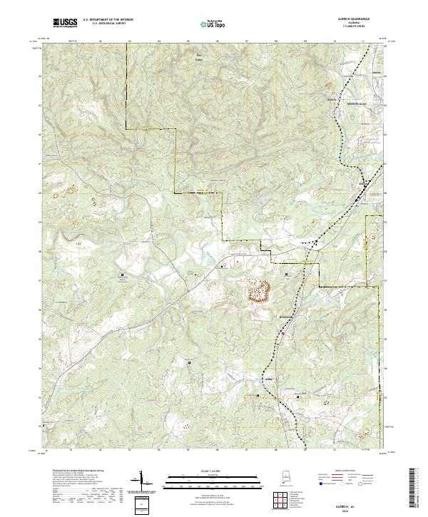
2024 Map of Aldrich
USGS Topo · Published 2024About this map
The Cahaba River and its tributary, the Little Cahaba River, anchor this modern topography of the Bibb and Shelby County line. This area reflects a long history of industrial activity, particularly centered around Brierfield and Aldrich. The presence of labels like Furnace Branch points to the region's legacy of iron production, which once thrived along these waterways. In the northeastern corner, the University of Montevallo Lake and College Lake mark the edges of the local academic landscape. Numerous burial sites, including Cahaba Valley Baptist Church Cem, Carlton Hill Cem, and Six Mile Cem, are scattered throughout the hills and valleys of Pea Ridge, offering valuable data points for genealogists tracking family settlements along the old Birmingham St and Old Selma Rd corridors.
Find a feature on this map
97 named features on this map. Tap any name to fly to it.
Don’t see what you’re looking for? This feature index may not catch every label — zoom into the map to look around manually.
Map Details
Editions of this 2024 Aldrich Map
This is the sole edition of this map. No revisions or reprints were ever made.
Other maps of this area

1890 · Bessemer
USGS Topo · 1:125,000

1891 · Clanton
USGS Topo · 1:125,000

1892 · Bessemer
USGS Topo · 1:125,000

1899 · Brookwood
USGS Topo · 1:125,000

1910 · Montevallo
USGS Topo · 1:62,500

1934 · Blocton
USGS Topo · 1:48,000

1940 · Blocton
USGS Topo · 1:62,500

1953 · Montgomery
USGS Topo · 1:250,000

1953 · Birmingham
USGS Topo · 1:250,000

1956 · Birmingham
USGS Topo · 1:250,000