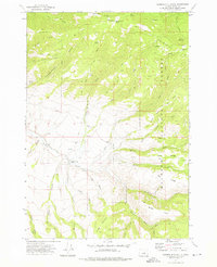
1972 Map of Aldrich Mountain South
USGS Topo · Published 1976About this map
Malheur National Forest dominates this landscape in central Oregon, where the high-altitude terrain of the Aldrich Mountains falls away into a complex network of canyons and gulches. The Murderers Creek Ranch and Weaver Cabin provide evidence of the remote ranching and forest management activities in this region during the early 1970s. The map reveals an intricate watershed system feeding into Murderers Creek, including the lengthy East Fork South Fork Murderers Creek. Unique geological and topograhic features like Shake Table and Timber Mountain characterize the southern portion of the quadrangle. Early 1970s land use is visible through a system of jeep trails and pack trails that navigate through steep drainages like Chickenhouse Gulch and Wylie Gulch, connecting isolated locations such as Cabbage Patch Camp and Todd Creek Camp.
Find a feature on this map
39 named features on this map. Tap any name to fly to it.
Don’t see what you’re looking for? This feature index may not catch every label — zoom into the map to look around manually.
Map Details
Editions of this 1972 Aldrich Mountain South Map
2 editions found
Other maps of this area

1932 · Dayville
USGS Topo · 1:125,000

1936 · Dayville
USGS Topo · 1:125,000

1940 · Aldrich Mtn.
USGS Topo · 1:62,500

1943 · Aldrich Mtn.
USGS Topo · 1:62,500

1955 · Canyon City
USGS Topo · 1:250,000

1959 · Canyon City
USGS Topo · 1:250,000

1961 · Izee
USGS Topo · 1:62,500

1972 · Big Weasel Sprs
USGS Topo · 1:24,000
1972 · Aldrich Mountain North
USGS Topo · 1:24,000
1972 · Aldrich Gulch
USGS Topo · 1:24,000