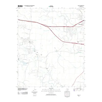
2010 Map of Aledo
USGS Topo · Published 2010About this map
Aledo and the surrounding ranch lands of western Tarrant County are documented here as the area transitioned from its rural roots into a suburban landscape. The historic E Bankhead Hwy passes through this corridor, north of where the Clear Fork Trinity River winds through the southern half of the quadrangle. Local family history is rooted in the presence of the Underwood Cemetery, Mcconnel Cemetery, and Brown Cemetery, which sit among rolling topography carved by Marys Creek and its various branches. Smaller private aviation sites like the Triple S Airport, Markum Ranch Airport, and Bucker Field underscore the sprawling nature of land ownership here during this period. Water resources such as Lake Montex and Petitfils Lake provide focal points for the landscape, while the settlement at Iona serves as a marker for the area's older residential patterns.
Find a feature on this map
50 named features on this map. Tap any name to fly to it.
Don’t see what you’re looking for? This feature index may not catch every label — zoom into the map to look around manually.
Map Details
Editions of this 2010 Aledo Map
This is the sole edition of this map. No revisions or reprints were ever made.
Other maps of this area

1891 · Weatherford
USGS Topo · 1:125,000

1893 · Weatherford
USGS Topo · 1:125,000

1894 · Fort Worth
USGS Topo · 1:125,000

1932 · Springtown
USGS Topo · 1:62,500

1954 · Dallas
USGS Topo · 1:250,000

1955 · Aledo
USGS Topo · 1:24,000

1955 · Primrose
USGS Topo · 1:24,000
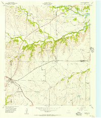
1955 · Cresson
USGS Topo · 1:24,000

1955 · Lake Worth
USGS Topo · 1:24,000

1955 · Benbrook
USGS Topo · 1:24,000