
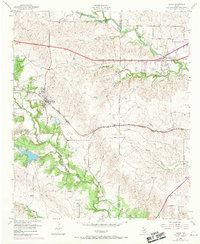
1955 Map of Aledo
USGS Topo · Published 1956About this map
Aledo and the western edge of Tarrant County are captured in the mid-1950s, showing a landscape defined by the drainage of the Clear Fork Trinity River and the steady path of the Texas and Pacific railroad. The map documents rural settlement patterns before the full expansion of the Fort Worth suburbs, highlighting small communities like Iona and Benbrook. Of particular interest to family historians are the scattered burial sites such as McConnell Cem, Underwood Cemetery, and Brown Cemetery.
Find a feature on this map
28 named features on this map. Tap any name to fly to it.
Don’t see what you’re looking for? This feature index may not catch every label — zoom into the map to look around manually.
Map Details
Editions of this 1955 Aledo Map
4 editions found
Other maps of this area

1891 · Weatherford
USGS Topo · 1:125,000

1893 · Weatherford
USGS Topo · 1:125,000

1894 · Fort Worth
USGS Topo · 1:125,000

1932 · Springtown
USGS Topo · 1:62,500

1954 · Dallas
USGS Topo · 1:250,000

1955 · Primrose
USGS Topo · 1:24,000
1955 · Cresson
USGS Topo · 1:24,000

1955 · Lake Worth
USGS Topo · 1:24,000

1955 · Benbrook
USGS Topo · 1:24,000

1955 · Haltom City
USGS Topo · 1:62,500