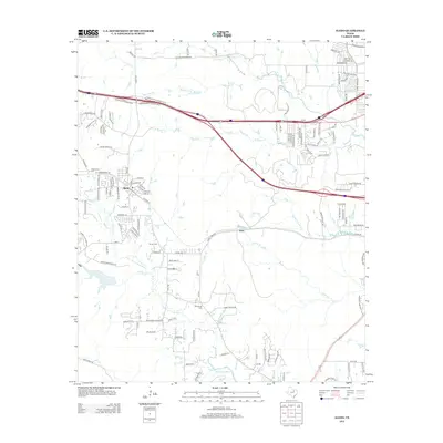
2012 Map of Aledo
USGS Topo · Published 2012About this map
Aledo serves as the primary hub of this landscape, situated at the confluence of several local roads just north of the Clear Fork Trinity River. The settlement pattern reflects significant suburban expansion, particularly in the northeast quadrant near Iona, where a dense network of residential streets like Ambling Trl and Unity Dr has emerged. Despite this modern growth, the area retains its early roots through several family-named burial grounds, including Underwood Cem near the western edge and McConnel Cem to the south.
Find a feature on this map
122 named features on this map. Tap any name to fly to it.
Don’t see what you’re looking for? This feature index may not catch every label — zoom into the map to look around manually.
Map Details
Editions of this 2012 Aledo Map
This is the sole edition of this map. No revisions or reprints were ever made.
Other maps of this area
1891 · Weatherford
USGS Topo · 1:125,000
1893 · Weatherford
USGS Topo · 1:125,000
1894 · Fort Worth
USGS Topo · 1:125,000
1932 · Springtown
USGS Topo · 1:62,500

1954 · Dallas
USGS Topo · 1:250,000
1955 · Aledo
USGS Topo · 1:24,000
1955 · Primrose
USGS Topo · 1:24,000
1955 · Cresson
USGS Topo · 1:24,000
1955 · Lake Worth
USGS Topo · 1:24,000
1955 · Benbrook
USGS Topo · 1:24,000