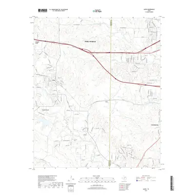
2019 Map of Aledo
USGS Topo · Published 2019About this map
Aledo and the surrounding ranch lands of Parker Co and Tarrant Co are captured here as suburban growth intersects with the drainage systems of the Trinity River basin. The landscape is defined by the Clear Fork Trinity River and its numerous tributaries, including Little Marys Cr, Walnut Cr, and Turkey Cr. These waterways create a rolling topography that has historically shaped the placement of local homesteads and small communities like Iona and Annetta South.
Find a feature on this map
60 named features on this map. Tap any name to fly to it.
Don’t see what you’re looking for? This feature index may not catch every label — zoom into the map to look around manually.
Map Details
Editions of this 2019 Aledo Map
This is the sole edition of this map. No revisions or reprints were ever made.
Other maps of this area

1891 · Weatherford
USGS Topo · 1:125,000

1893 · Weatherford
USGS Topo · 1:125,000

1894 · Fort Worth
USGS Topo · 1:125,000

1932 · Springtown
USGS Topo · 1:62,500

1954 · Dallas
USGS Topo · 1:250,000

1955 · Aledo
USGS Topo · 1:24,000

1955 · Primrose
USGS Topo · 1:24,000
1955 · Cresson
USGS Topo · 1:24,000

1955 · Lake Worth
USGS Topo · 1:24,000

1955 · Benbrook
USGS Topo · 1:24,000