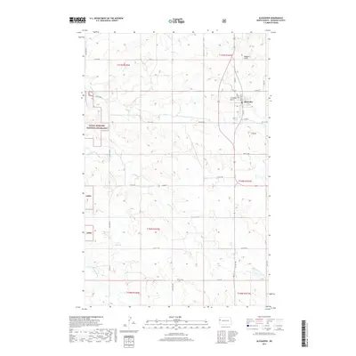
2017 Map of Alexander
USGS Topo · Published 2017About this map
Alexander serves as the primary hub of this McKenzie County landscape, situated at the intersection of a grid-like network of rural roads such as Main St and Elk St. The surrounding terrain is characterized by significant topographical elevations including Ragged Butte, Foreman Butte, and the uniquely named A Butte. These landmarks rise above the drainage basins of Lonesome Cr, Antelope Cr, and Charbonneau Cr, which wind through the plains. Much of the western portion of this survey is dedicated to the Little Missouri National Grassland, reflecting a land-use pattern where open prairie conservation meets the developed townsite. The map reveals the precise section-line road system common to the northern Great Plains, providing a clear view of the ranching and agricultural layout defining the region during this era.
Find a feature on this map
37 named features on this map. Tap any name to fly to it.
Don’t see what you’re looking for? This feature index may not catch every label — zoom into the map to look around manually.
Map Details
Editions of this 2017 Alexander Map
This is the sole edition of this map. No revisions or reprints were ever made.
Other maps of this area

1953 · Watford City
USGS Topo · 1:250,000

1957 · Watford City
USGS Topo · 1:250,000

1967 · Watford City
USGS Topo · 1:250,000

1969 · Cartwright NE
USGS Topo · 1:24,000

1972 · Bear Butte
USGS Topo · 1:24,000

1972 · Alexander
USGS Topo · 1:24,000

1972 · Moline School
USGS Topo · 1:24,000

1972 · Rawson
USGS Topo · 1:24,000

1972 · Charbonneau
USGS Topo · 1:24,000

1972 · Sather Lake
USGS Topo · 1:24,000