
1969 Map of Cartwright NE
USGS Topo · Published 1971About this map
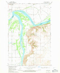
Lake Sakakawea dominates the northern reaches of this Missouri River Basin survey, where the water is recorded at a normal pool elevation of 1838 feet. The reservoir and the Missouri River itself form the boundary between Buford to the north and the southern townships, crossing between Williams and McKenzie counties. This late-1960s landscape is defined by its massive water management projects and the utility infrastructure shown by a prominent Pipeline traversing the central hills.
Find a feature on this map
12 named features on this map. Tap any name to fly to it.
Don’t see what you’re looking for? This feature index may not catch every label — zoom into the map to look around manually.
Map Details
Editions of this 1969 Cartwright NE Map
This is the sole edition of this map. No revisions or reprints were ever made.
Other maps of this area

1953 · Williston
USGS Topo · 1:250,000

1953 · Watford City
USGS Topo · 1:250,000

1957 · Williston
USGS Topo · 1:250,000

1957 · Watford City
USGS Topo · 1:250,000

1967 · Watford City
USGS Topo · 1:250,000

1968 · Trenton SW
USGS Topo · 1:24,000
1968 · Buford
USGS Topo · 1:24,000

1969 · Trenton
USGS Topo · 1:24,000

1972 · Alexander
USGS Topo · 1:24,000

1972 · Charbonneau
USGS Topo · 1:24,000