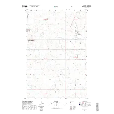
2020 Map of Alexander
USGS Topo · Published 2020About this map
Alexander serves as the central hub for this portion of McKenzie County, positioned along the edge of the Little Missouri National Grassland. The landscape is defined by its significant relief, featuring prominent elevations such as Ragged Butte, Foreman Butte, and another landmark simply labeled Butte. These landforms rise above a network of drainages, including Lonesome Cr, Antelope Cr, and the westward-flowing Charbonneau Cr. The rural grid is well-established, with roads like Roughneck Rd and CC Dam Rd navigating the terrain. This map captures the intersection of organized agriculture and the protected natural expanses of the Lmng, illustrating the sparse but deliberate settlement pattern typical of the North Dakota badlands fringe during the early 21st century.
Find a feature on this map
41 named features on this map. Tap any name to fly to it.
Don’t see what you’re looking for? This feature index may not catch every label — zoom into the map to look around manually.
Map Details
Editions of this 2020 Alexander Map
This is the sole edition of this map. No revisions or reprints were ever made.
Other maps of this area

1953 · Watford City
USGS Topo · 1:250,000

1957 · Watford City
USGS Topo · 1:250,000

1967 · Watford City
USGS Topo · 1:250,000

1969 · Cartwright NE
USGS Topo · 1:24,000

1972 · Bear Butte
USGS Topo · 1:24,000

1972 · Alexander
USGS Topo · 1:24,000

1972 · Moline School
USGS Topo · 1:24,000

1972 · Rawson
USGS Topo · 1:24,000

1972 · Charbonneau
USGS Topo · 1:24,000

1972 · Sather Lake
USGS Topo · 1:24,000