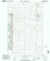
1997 Map of Alexander
USGS Topo · Published 2001About this map
The town of Alexander anchors this high-plains landscape in McKenzie County, showing a quiet prairie settlement defined by its local institutions and the geography of the Missouri Plateau. A local legacy of education is preserved at Randolph Sch, while the town itself features the Lewis and Clark Trail Museum and a dedicated Athletic Field. To the west, the boundary of the Little Missouri National Grassland marks a shift from private ranching to public lands, where the terrain becomes more varied around R Wolf Ranch and F Monson Ranch. Drainage patterns are carved by the winding paths of Lonesome Creek, Antelope Creek, and Charbonneau Creek. Industrial infrastructure is visible in the corridor of the Northern Border Pipeline, which cuts across the northern reaches near prominent elevations like Ragged Butte and Foreman Butte.
Find a feature on this map
23 named features on this map. Tap any name to fly to it.
Don’t see what you’re looking for? This feature index may not catch every label — zoom into the map to look around manually.
Map Details
Editions of this 1997 Alexander Map
This is the sole edition of this map. No revisions or reprints were ever made.
Other maps of this area

1953 · Watford City
USGS Topo · 1:250,000

1957 · Watford City
USGS Topo · 1:250,000

1967 · Watford City
USGS Topo · 1:250,000

1969 · Cartwright NE
USGS Topo · 1:24,000

1972 · Bear Butte
USGS Topo · 1:24,000

1972 · Alexander
USGS Topo · 1:24,000

1972 · Moline School
USGS Topo · 1:24,000

1972 · Rawson
USGS Topo · 1:24,000

1972 · Charbonneau
USGS Topo · 1:24,000

1972 · Sather Lake
USGS Topo · 1:24,000