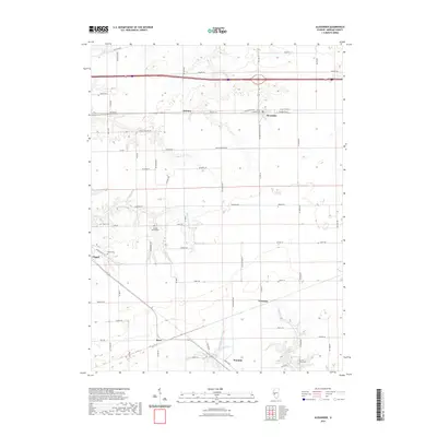
2021 Map of Alexander
USGS Topo · Published 2021About this map
Alexander and Franklin anchor this portion of Morgan County, where a grid of rural roads connects several small, historic rail-and-road settlements. The landscape is defined by the winding course of Mauvaise Terre Cr and its tributaries, such as Woods Cr, which cut through the agricultural sections. For genealogists, the map is particularly valuable for identifying several local burial grounds, including Sulphur Springs Cem near the center of the sheet and Sacred Heart Cem to the south. The proximity of Orleans, Pisgah, and Yeomans illustrates the tight-knit network of communities that developed around the transport corridors of central Illinois. Named roads like Old State Rd and Prairie College Rd suggest the early institutional and thoroughfare history of the region, while the presence of the Union Baptist Rd points to the religious life of these prairie townships.
Find a feature on this map
66 named features on this map. Tap any name to fly to it.
Don’t see what you’re looking for? This feature index may not catch every label — zoom into the map to look around manually.
Map Details
Editions of this 2021 Alexander Map
This is the sole edition of this map. No revisions or reprints were ever made.
Other maps of this area

1909 · Tallula
USGS Topo · 1:62,500

1924 · Waverly
USGS Topo · 1:62,500

1926 · Waverly
USGS Topo · 1:62,500

1932 · Jacksonville
USGS Topo · 1:62,500

1932 · Virginia
USGS Topo · 1:62,500

1936 · Virginia
USGS Topo · 1:62,500

1937 · Jacksonville
USGS Topo · 1:62,500

1940 · Tallula
USGS Topo · 1:62,500

1948 · Quincy
USGS Topo · 1:250,000

1956 · Quincy
USGS Topo · 1:250,000