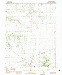
1983 Map of Alexander
USGS Topo · Published 1983About this map
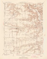
Alexander and its surrounding Morgan County farmsteads appear here during the early 1980s, revealing a landscape defined by industrial rail lines and small rural hubs. The corridor of the Norfolk and Western railroad anchors the northern portion of the map, passing through the village of Orleans, while the Burlington Northern and Gulf Central Illinois lines intersect near Rees and Yeomans to the south.
Find a feature on this map
21 named features on this map. Tap any name to fly to it.
Don’t see what you’re looking for? This feature index may not catch every label — zoom into the map to look around manually.
Map Details
Editions of this 1983 Alexander Map
This is the sole edition of this map. No revisions or reprints were ever made.
Other maps of this area

1909 · Tallula
USGS Topo · 1:62,500

1924 · Waverly
USGS Topo · 1:62,500

1926 · Waverly
USGS Topo · 1:62,500

1932 · Jacksonville
USGS Topo · 1:62,500
1932 · Virginia
USGS Topo · 1:62,500
1936 · Virginia
USGS Topo · 1:62,500
1937 · Jacksonville
USGS Topo · 1:62,500
1940 · Tallula
USGS Topo · 1:62,500

1948 · Quincy
USGS Topo · 1:250,000

1956 · Quincy
USGS Topo · 1:250,000