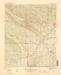
1944 Map of Alexander
USGS Topo · Published 1946About this map
Alexander and Mabelvale serve as focal points for this 1940s landscape where Pulaski and Saline counties meet. The region is defined by a dense network of institutional sites and small rural communities, including the Salasco Sanitarium, the Womens Penitentiary, and the State Girls Industrial Home. These facilities are situated near Collegeville, positioned south of the winding Fourche Creek. The transportation corridor is anchored by the Missouri Pacific railroad, which cuts through the southern terrain near Alexander Mountain.
Find a feature on this map
54 named features on this map. Tap any name to fly to it.
Don’t see what you’re looking for? This feature index may not catch every label — zoom into the map to look around manually.
Map Details
Editions of this 1944 Alexander Map
2 editions found

Other maps of this area

1890 · Benton
USGS Topo · 1:125,000

1891 · Little Rock
USGS Topo · 1:125,000

1893 · Little Rock
USGS Topo · 1:125,000

1894 · Benton
USGS Topo · 1:125,000

1935 · Little Rock
USGS Topo · 1:24,000

1935 · North Little Rock
USGS Topo · 1:24,000

1935 · Alexander
USGS Topo · 1:48,000

1938 · Benton
USGS Topo · 1:48,000

1941 · Alexander
USGS Topo · 1:62,500

1943 · Pinnacle Mtn
USGS Topo · 1:31,680