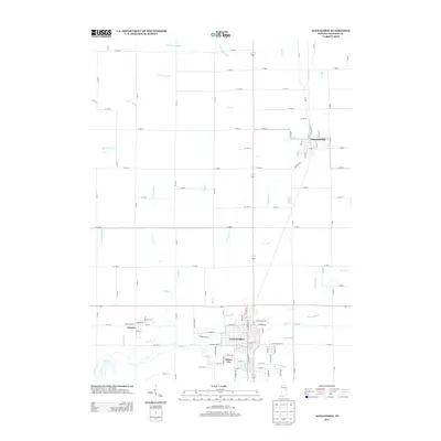
2013 Map of Alexandria
USGS Topo · Published 2013About this map
Alexandria serves as the central hub of this Northern Madison County landscape, where the grid-based agricultural layout meets several significant waterways. The map documents the spatial relationship between the city and surrounding communities like Summitville to the northeast and Gimco City near the urban core. The region is defined by an intricate network of natural and engineered drainage systems, including Pipe Cr and Lilly Cr, which carve through the farmland. These watercourses, along with smaller tributaries like Gimco Brook and Light Run, illustrate the essential hydrological management required for this Indiana prairie terrain. Notable local nomenclature is preserved in labels like Pisgah Run and Beulah Run, providing specific geographic markers for genealogists and local historians tracking land use and settlement patterns in the early 21st century.
Find a feature on this map
76 named features on this map. Tap any name to fly to it.
Don’t see what you’re looking for? This feature index may not catch every label — zoom into the map to look around manually.
Map Details
Editions of this 2013 Alexandria Map
This is the sole edition of this map. No revisions or reprints were ever made.
Other maps of this area

1953 · Muncie
USGS Topo · 1:250,000

1956 · Muncie
USGS Topo · 1:250,000

1960 · Gilman
USGS Topo · 1:24,000

1960 · Elwood
USGS Topo · 1:24,000

1960 · Point Isabel
USGS Topo · 1:24,000

1960 · Alexandria
USGS Topo · 1:24,000

1960 · Fairmount
USGS Topo · 1:24,000

1960 · Gas City
USGS Topo · 1:24,000

1960 · Gaston
USGS Topo · 1:24,000

1960 · Anderson North
USGS Topo · 1:24,000