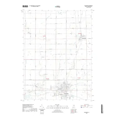
2019 Map of Alexandria
USGS Topo · Published 2019About this map
Alexandria serves as the primary hub of this Madison County landscape, where the urban grid meets a network of agricultural drainage and small-town settlements. To the north, the village of Summitville occupies the corner of T22N R8E, while Orestes and the industrial-named Gimco City sit further south along the regional road network. The terrain is defined by a dense system of waterways including Pipe Creek, Mud Cr, and Lilly Cr, illustrating the intensive water management necessary for the area's development. Scattered throughout the townships are several ancestral burial grounds, such as Musick Cem and Forrestville Cem, which offer significant touchpoints for genealogists. The map also captures several smaller runs and ditches like Dong Run and Jones Clark Ditch, which reveal the fine-grained hydrography of the Indiana heartland as it appeared in the late 2010s.
Find a feature on this map
79 named features on this map. Tap any name to fly to it.
Don’t see what you’re looking for? This feature index may not catch every label — zoom into the map to look around manually.
Map Details
Editions of this 2019 Alexandria Map
This is the sole edition of this map. No revisions or reprints were ever made.
Other maps of this area

1953 · Muncie
USGS Topo · 1:250,000

1956 · Muncie
USGS Topo · 1:250,000

1960 · Gilman
USGS Topo · 1:24,000

1960 · Elwood
USGS Topo · 1:24,000

1960 · Point Isabel
USGS Topo · 1:24,000

1960 · Alexandria
USGS Topo · 1:24,000

1960 · Fairmount
USGS Topo · 1:24,000

1960 · Gas City
USGS Topo · 1:24,000

1960 · Gaston
USGS Topo · 1:24,000

1960 · Anderson North
USGS Topo · 1:24,000